
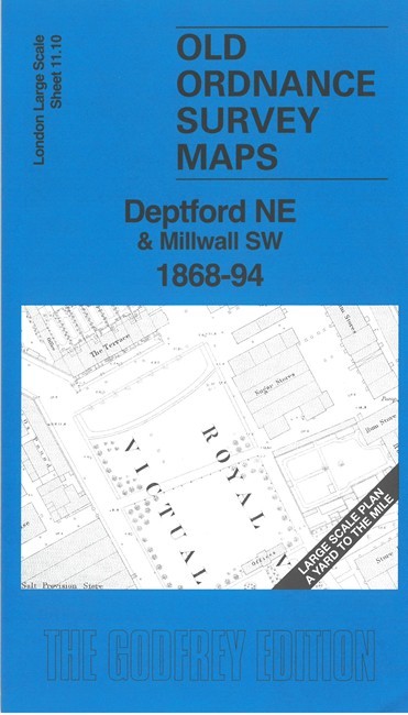
Deptford NE & Millwall SW 1868-94 London Large Scale 11.10 by Pamela Taylor
USD 5.05 USD
Specifications
| Type | Street Map/Directory |
| Author | Pamela Taylor |
| Publisher | Alan Godfrey Maps |
| Topic | Local History |
| Subject | History |
| Country Of Origin | United Kingdom |
| ISBN | 9781787219403 |
This very detailed map covers the northern part of Deptford around the Royal Victoria Victualling Yard. Features include the Victualling Yard shown in detail with various store buildings - Salt Provision Store, Rum Stores, Chocolate Mill, Ox Slaughter House etc - and the Cooperage. Further north is the Wet Dock, Thames Junction Branch railway to Deadman's Dock, St George's Wharf. Across the river are West Ferry Road and various riverside wharves and works, including Chain and Anchor Works, Phoenix Iron Works, Britannia Dock. On the reverse we include the 1894 map, showing the same area at a later stage. We also include an introduction to the history of the area.
Related Items
Europe Postcodes Map, Poster of European Postcodes
Edwardian Ordnance Survey Map Large Series Fold Out Canvas Kent c.1912 Antique

Ordnance Survey One-Inch 7th Series Map – Sheet 70 – Jedburgh

Philip’s Pilgrimage Map of Britain and Ireland by Philip’s Maps (Sheet map)
Gainsborough (North) or (South) 1898 Lincolnshire sheets 42.08 or 42.12

Historical Atlas of Asia – I Barnes & R Hudson (Illustrated Hardcover, 1998)

Isle of Man Walking Map Outdoor Hiking Strong Waterproof Light Navigation

Vintage OS Ordnance Survey One Inch Map – Lancaster Kendal – Sheet 89- c1971