
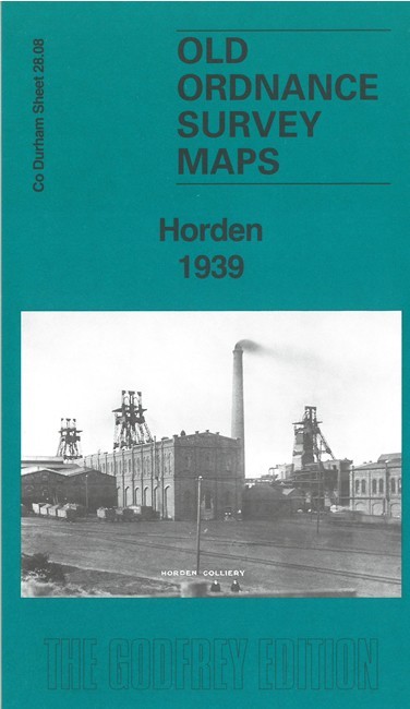
Horden 1939 County Durham 28.08 by John Griffiths
USD 5.04 USD
Specifications
| Type | Street Map/Directory |
| Author | John Griffiths |
| Publisher | Alan Godfrey Maps |
| Topic | Local History |
| Subject | History |
| Country Of Origin | United Kingdom |
| ISBN | 9781787219762 |
This detailed map of Horden is double-sided for maximum coverage. The main map covers the village, showing individual houses and Cotsford Park, Dene Villas, Welfare Park, railway with station, Baths, Yoden Village, Football Ground, etc. On the reverse we include part of sheet 28.04 extending coverage north to include Horden Colliery, railway layout, aerial cable, Horden Hall, etc.
Related Items

OLD ORDNANCE SURVEY MAPS: NORTH HAMMERSMITH & BEDFORD PARK 1912

Cape Wrath Trail North by Harvey Map Services Ltd. (Sheet map, folded)

Frenchmen, Desire, Good Children : … and Other Streets of New Orleans! by John
Vintage Bartholomews Revised Half Inch Contoured Maps Cambridge Sheet 20 Cloth.

Bedford & Huntingdon: OS landranger: 1:50,000 map of Britain: #153
1988 Ordnance Survey Landranger Second Series Map 143 Ely And Wisbech

The Visual Dictionary Of Military Uniforms – 1992

Vintage 1985 Ladybird World Atlas Illustrated Geography Reference Book Hardback