
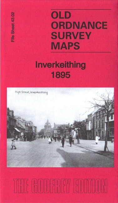
Inverkeithing 1895 Fifeshire Sheet 43.02 by Alan Godfrey
USD 5.00 USD
Specifications
| Type | Street Map/Directory |
| Author | Alan Godfrey |
| Publisher | Alan Godfrey Maps |
| Topic | Local History |
| Subject | History |
| Country Of Origin | United Kingdom |
| ISBN | 9781787212121 |
This very detailed map is double-sided for maximum coverage. The north map covers the town centre, while the map to the south covers the harbour, inner bay, Cruicks area and southward to the Ferry Hills. Features include town centre with individual buildings neatly shown, parish church, Boreland, railway with station, Town Hall, Bellsknowes, U.P. church, Pinkerton Bridge, harbour, shipbuilding yard, The Shore, The Roods, paper mill, NBR North Queensferry Branch, railway to harbour, Cruicks Pottery, Jamestown, Castlandhill House, Limpet Ness, Ferry Hills, etc.
Related Items

Vintage Ordnance Survey One Inch Map Of Aldershot

12 1″ Ordnance Survey Map 7th Series 106 116 129 163 168 170 181 187 188 189 198
Bartholomew National Map Series South Devon sheet 2 Red cover

Beaminster, Bridport & West Dorset 1905 One Inch Sheet 327 by Tony Painter

Of the Flesh 18 Stories of Modern Horror by Adorah Nworah (Hardback Book)

Tipton 1904 Staffordshire Sheet 67.08 by Robin Pearson (Sheet map, folded)

Bartholomew’s FIRTH OF TAY Revised Half-Inch Sheet 49 Vintage Cloth Map

c1907 Harmsworth Plate No. 184 West Indies: Lesser Antilles