
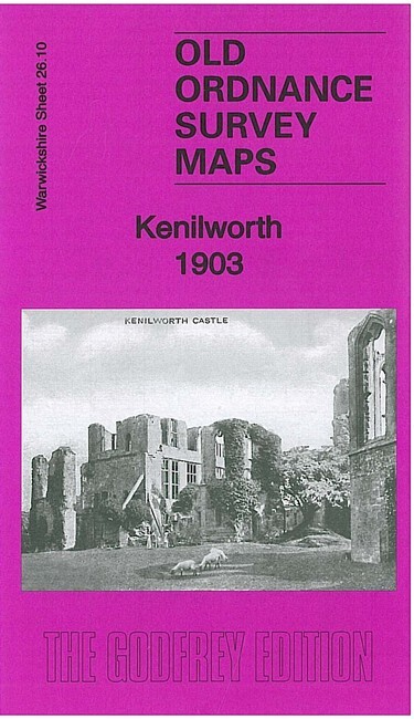
Kenilworth 1903 Warwickshire Sheet 26.10 by Malcolm Nixon
USD 5.04 USD
Specifications
| Type | Street Map/Directory |
| Author | Malcolm Nixon |
| Publisher | Alan Godfrey Maps |
| Topic | Local History |
| Subject | History |
| Country Of Origin | United Kingdom |
| ISBN | 9781847846891 |
This detailed map is double-sided for maximum coverage. The main map covers the area from Malthouse Lane eastward to Knoll House and Knowle Hill, and The Common southward to Station Road. Features include Mill End area, Lower Ladies Hills area, Whitemoor area, Parkfield, railway (station is largely south of the map), Cherry Orchard Brick Works, St Nicholas church, The Spring area, St Mary's Priory ruins, Abbey Hotel, The Hall, High Street area, Fieldgate House, Nurseries, Fire Engine Station etc. On the reverse we include part of adjacent sheet 26.09 extending coverage east to include Kenilworth Castle and Castle Green
Related Items

MAP OF Malvern Link 1926: Worcestershire Sheet 40.05 by Alan Godfrey NEW

MAP OF Amble 1896 Northumberland Sheet 46.04 by John Griffiths NEW 9780850549560
Landranger Maps: Cambridge, Newmarket an… by Ordnance Survey Sheet map, folded
One Inch Ordnance Survey Map Sheet 153 Swansea 1972 Paper – Vintage Foldout
Denton West & Gorton Bridge 1891 Coloured, 1916 or 1934 Lancashire Sheet 105.13
MAP OF Draperstown & the South Sperrins Irish One Inch Sheet 26 NEW
Ordnance Survey 1:1250 Plan NT 2168 NE Colinton Edinburgh 1966 Vintage Map
Vintage Ordnance Survey Pathfinder Wigan & Ormskirk 1982 Sheet SD 40/50