

Kidsgrove or Kidsgrove (West) 1897 Staffordshire Sheet 6.15 or 6.16
USD 5.05 USD
Specifications
| Direction | west |
| Type | Street Map/Directory |
| Author | Derrick Pratt |
| Publisher | Alan Godfrey Maps |
| Topic | Local History |
| Subject | History |
| Country Of Origin | United Kingdom |
This detailed map covers the wesatern part of Kidsgrove, with coverage stretching from Kidsgrove and Harecastle stations westward to Butt Lane, Coalpit Hill and Swallowmoor Wood. Features include Linleywood, Slum Wood, Bunkers Hill Colliery with mineral line and tramway, Coalpit Hill, Hollins, St Saviour's church, Butt Lane, Woodshutts Colliery, Hollin's Wood Colliery (disused), Lowerash Farm, Slappenfield Coal Pit (disused), Hardings Wood, Harecastle station, Albion Foundry, Potteries Loop Line with Kidsgrove station, etc.
Related Items

MAP OF ROTHERHITHE SOUTHWARK PARK 1872-94 LONDON LARGE SCALE SHEET 7.98 NEW

California Thomas Bros Road Atlas Drivers Guide Vintage 80’s CA Fold Out Map

Vintage Ordnance Survey Landranger East London 1978 Map 177

Aberystwyth and Cwm Rheidol 213 Explorer Map Ordnance Survey + Digital Download

Atlas of World History Hammond Incorporated World Atlas

Gilbert T. Bell Renfrew 1895 (Map) (UK IMPORT)

Ordnance Survey Explorer 1:25,000, Sheet 290 York, Selby & Tadcaster – 2006
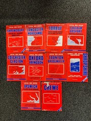
10x vintage old philips Local super County Red Book Map street map guides bundle