

MAP OF Brandon 1903 Suffolk Sheet 6.16 by Robert Malster 6.16 NEW
USD 4.39 USD
Specifications
| Return Postage Will Be Paid By | Buyer |
| Returns Accepted | Returns Accepted |
| After Receiving The Item, Your Buyer Should Cancel The Purchase Within | 30 days |
| Type | Street Map/Directory |
| Publication Name | N/A |
| Author | Robert Malster |
| Publisher | Alan Godfrey Maps |
| Topic | Local History |
| Subject | History |
Here are the details of maps for Brandon Suffolk Sheet 6.16 Brandon 1903 - published 2001; introduction by Robert Malster. ISBN 978-1-84151-303-4 This map straddles the Suffolk border, and is also Norfolk Sheet 92.16. It covers the town of Brandon in good detail, and features here include High Street, Market Hill, London Road, Thetford Road, Bury Road, Gashouse Drove, old limekilns, fur manufactory, St Peter's church. Town Street, Brandon Hall and Foord House are in the SW corner. The Little Ouse River runs through the map and north of this is the Great Eastern Railway with (in Norfolk) Brandon station. A directory of Brandon in 1896 is included on the back.
Related Items
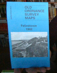
MAP OF Felixstowe 1902 Suffolk Sheet 90.01 by Robert Malster NEW
Shropshire Sheet 43.13 Buildwas Abbey & Benthall Edge 1901

Warrington 1905 Lancashire Sheet 116.01 by Alan Godfrey (Sheet map, folded)

MAP OF Smallheath & Sparkbrook 1888 Warwickshire Sheet 14.10 NEW 9781847849663

Robert Woodhouse Stockton-on-Tees and Thornaby 1897 (Map) (UK IMPORT)
Govan 1894: Lanarkshire Sheet 06.09a by Gilbert Bell SHEET MAP 9781847844507

Essential World Atlas, 10th Edition – Paperback By DK – GOOD

Star Trek Stellar Cartography Starfleet Reference Library Maps from the Universe