

MAP OF Litherland (East) 1906 Lancashire Sheet 99.10 by Kay Parrott NEW
USD 4.69 USD
Specifications
| Type | Street Map/Directory |
| Author | Kay Parrott |
| Publisher | Alan Godfrey Maps |
| Topic | Local History |
| Subject | History |
| Country Of Origin | United Kingdom |
| ISBN | 9781787210660 |
Lancashire Sheet 99.10 Litherland East 1906 - published 2017; intro by Kay Parrott. The main map covers a relatively rural area east of Litherland. Features include St Philip's church, Stanley Park, Brook Farm, tar distillery, railway with Aintree Sorting Sidings, Ford station, Stand Park Farm.
Related Items

Govan 1894 Lanarkshire Sheet 06.09a by Gilbert Bell (Sheet map, folded)

Northampton & Market Harborough Bricworth & Pitsford Water map223

Bournemouth A-Z Pocket Street Map by A-Z Maps (Sheet map, folded)

Ordnance Survey Landranger Penrith and Keswick map

Thetford Forest in the Brecks by Ordnance Survey (Sheet map, folded)
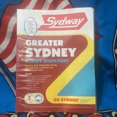
Sydway Greater Sydney & Blue Mountains Street Directory Edition 4 With Cover

OS PATHFINDER SHEET SX 26/36 LISKEARD WALKERS MAP 1:25 000 SCALE

1960 NORTH WALES Vintage Bartholomew’s Half-Inch Contoured cloth Map Sheet 27