
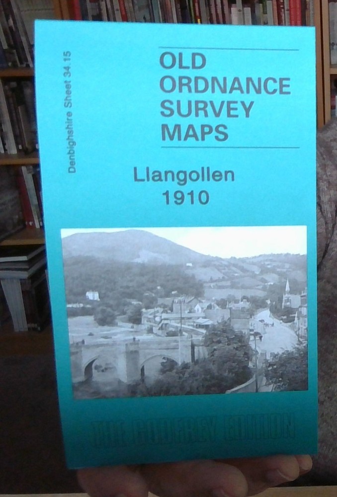
MAP OF Llangollen 1910 Denbighshire Sheet 34.15 by Derrick Pratt NEW
USD 4.98 USD
Specifications
| Type | Street Map/Directory |
| Publication Name | MAP OF Llangollen 1910 |
| Author | Derrick Pratt |
| Publisher | Alan Godfrey Maps |
| Topic | Local History |
| Subject | History |
| Country Of Origin | United Kingdom |
| ISBN | 9781841519548 |
This detailed map covers the town of Llangollen, described by author Derrick Pratt as "a function of church, bridge, Cistercian abbey, a futile Welsh castle, abortive maerdref, a grant of markets, the Holyhead Road, quarries, textile mills and some magnificent scenery - roughly in that order". Most of the town is covered and coverage extends west to Barbers Bank, east to Pen-y-Coed and Maesmawr Farm. Features on the map include the railway and station, Pen-llyn, Smithfield, Llangollen Bridge, Fron-Bache, St Collen's church, River Dee, Shropshire Union Canal. On the reverse we include a directory of the town in 1895.
Related Items
OL 2 1 278 288 PEAK DISTRICT BRADFORD SHEFFIELD EXPLORER ORDNANCE SURVEY MAPS OS

POSTCODE MAP of London (Waterproof) – Master Atlas of Greater London A-Z Map /A6

OS Ordnance Survey Landranger Map 156 ‘Saxmundham’ – V Good condition

Ordnance Survey Outdoor Leisure 5: The English Lakes: North Eastern Area…

A-Z Bristol, Bath (A-Z Street Atlas) Paperback 1st Edition 1993
Dublin & Athlone – Vintage Bartholomew’s AA 4 miles To 1 Inch Cloth Backed Map

Footpath Map 17 Chesham & Berkhamsted Chiltern Society 1984 Fold Out Map

Treharris 1915 Glamorgan Sheet 19.11 by Ray Lawrence