
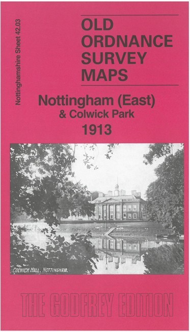
Nottingham (East) & Colwick Park 1913 Nottinghamshire Sheet 42.03
USD 4.98 USD
Specifications
| Type | Street Map/Directory |
| Author | Barrie Trinder |
| Publisher | Alan Godfrey Maps |
| Topic | Local History |
| Subject | History |
| Country Of Origin | United Kingdom |
| ISBN | 9781787218819 |
This map covers an area to the east of Nottingham and is double-sided for maximum coverage. The main map covers the easternmost streets of Nottingham, off Sneinton Dale and Sneinton Boulevard, with the Great Northern Railway and Thorneywood Station. It extends east to Colwick House and the Midland Railway's Nottingham & Lincoln line. The map on the reverse extends coverage southward to include St Christopher's Church, Trent Lane Junction, Colwick Hall, Colwick Park and most of the racecourse.
Related Items
Bromford Bridge 1913 Warwickshire Sheet 8.15 by Roger Lea

Ordnance Survey Landranger Map – Blackburn & Burnley – Sheet 103 – 1994

1958 Map Midland Red Bus Service Worcester Birmingham Nottingham Stafford Stoke
Vintage Ordnance Survey Map Sheet 180 Barnstaple And Ilfracombe

MAP OF Kidderminster 1921 Worcestershire Sheet 8.15 by John Boynton NEW

Ordnance Survey Landranger 1:50,000 sheet 187 Dorking, Reigate & Crawley – 1980

A-Z London District Postcode Map Atlas (A4 Size) London Borough Map
Bartholomew’s Half-inch Contoured Map – North Somerset, Sheet 7 – 1957