
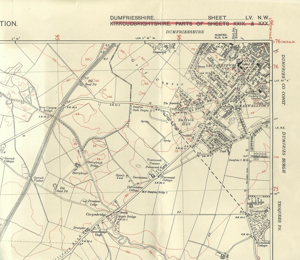
Ordnance Survey 6 inch -1 mile map Maxwelltown & Laurieknowe 1947 Dumfriesshire
USD 26.89 USD
Specifications
| Country Of Origin | United Kingdom |
| Date Of Publication | 1951 |
| Publication Name | Ordnance Survey |
| Publisher | Ordnance Survey |
| Subject | Historic map |
| Publication Year | 1947 |
| Series | Ordnance Survey |
| Type | City Map |
| Format | sheet map |
| Language | English |
| Country | England |
| Author | Ordnance Survey |
| Map Scale | 1:10560 |
Contours shown in red. Provisional Edition. Revision of 1929 with additions in 1946-47. Printed 1951. Approximate size is 56 x 43 cm. Covering an area on the ground 3 miles east to west and 2 miles north to south.
Related Items

MAP OF Belfast Lough 1900 Irish One Inch Sheet 29 by Alan Godfrey NEW

Bartholomew’s Mini World Atlas by Bartholomew, John Hardback Book The Fast Free

Freytag-Berndt WK 233 Lake Wörther – Ossiacher Lake- Faaker La (Map) (UK IMPORT)

MAP Hereford & Gloucester Vintage 1975 BARTHOLOMEW NATIONAL MAP SERIES No 13

5 x UK Ordnance Survey Road Maps Vintage 1970s/70s Inc. Lands End & Torquay. VGC
Ordnance Survey Map Of Great Britian – BODMIN AND LAUNCESTON – 1967 – 1/63360

Tudors: A High-Speed History by Terry Deary (English) Paperback Book

Brackley 1920 Northamptonshire Sheet 63.02 by Barrie Trinder