

Plymouth (North) 1912 Devon sheet 123.08b by Tony Painter
USD 5.05 USD
Specifications
| Type | Street Map/Directory |
| Author | Tony Painter |
| Publisher | Alan Godfrey Maps |
| Topic | Local History |
| Subject | History |
| Country Of Origin | United Kingdom |
| ISBN | 9781787218628 |
This map covers the northern part of Plymouth, with coverage stretching from Wyndham Square eastward to Lipson Farm and Lipson House, and from Grenville Road northward to Lockyer Road. Features include LSWR railway with Friary station, engine shed, Plymouth Workhouse, Freedom Fields, Lipson, GWR railway with Mutley station, North Road station, cemetery, Beaumont Park, RC Cathedral, Houndiscombe, St Jude's church, Ford Park area, Market Place, tramways etc. On the reverse we include extracts from contemporary street directories, together with introductions to the history of the area.
Related Items
OS Ordnance Survey 1″ New Popular Edition sheet 188 Torquay – 1946 on cloth
Liverpool (Hanover Street) 1864: Liverpool Sheet 29 by Kay Parrott SHEET MAP

Admiralty Charts SC 5603 – Falmouth to Hartland Point 7th Edition

Grays (East) & Little Thurrock 1916 Essex Sheet 95.07 by Tony Kirby
Barnett’s Street Plan of Ruislip & Northwood, Middlesex with Index to Streets.

Let’s Walk the North York Moors, The Western Area, 1st Edition – Brand New
North Breconshire 1908 One Inch Sheet 196 by Edward Parry
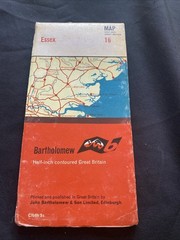
Essex Bartholomew Revised Half Inch contoured Cloth Map #16 (1280)