
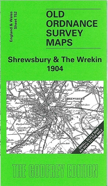
Shrewsbury & The Wrekin 1904 One Inch sheet 152 by Barrie Trinder
USD 5.05 USD
Specifications
| Type | One Inch Map |
| Author | Barrie Trinder |
| Publisher | Alan Godfrey Maps |
| Topic | Local History |
| Subject | History |
| Country Of Origin | United Kingdom |
| ISBN | 9781841515915 |
Coverage stretches from Pontesbury eastward to Wellington and Coalbrookdale, and from Bicton and Shrewsbury southward to Much Wenlock and Church Preen. The River Severn runs through the map, and to the south the foothills of the Stretton Hills and Wenlock Edge are appearing.
Related Items

Norwich City, Norw1ch, map, info, tourist sites, local adverts, vintage 1980s

MAP OF Tilbury Docks 1916 Essex Sheet 95.11 by Tony Kirby NEW 9781787216150
Cardiff and District 1890 (Map) Old O.S. Maps of Wales

Ordnance Survey Landranger Sheet 104 – LEEDS AND BRADFORD – 1979

Vintage Bartholomews Revised Half Inch Contoured Maps Cambridge Sheet 20 Cloth.

Ordnance Survey One-Inch Map of Great Britain Bundle

ORDNANCE SURVEY EXPLORER MAP #156 CHIPPENHAM & BRADFORD on AVON Wiltshire UK
Aberystwyth/Tywtn/Aberdyfi/Borth OS 135 Landranger Sheet Map Folded 1974