
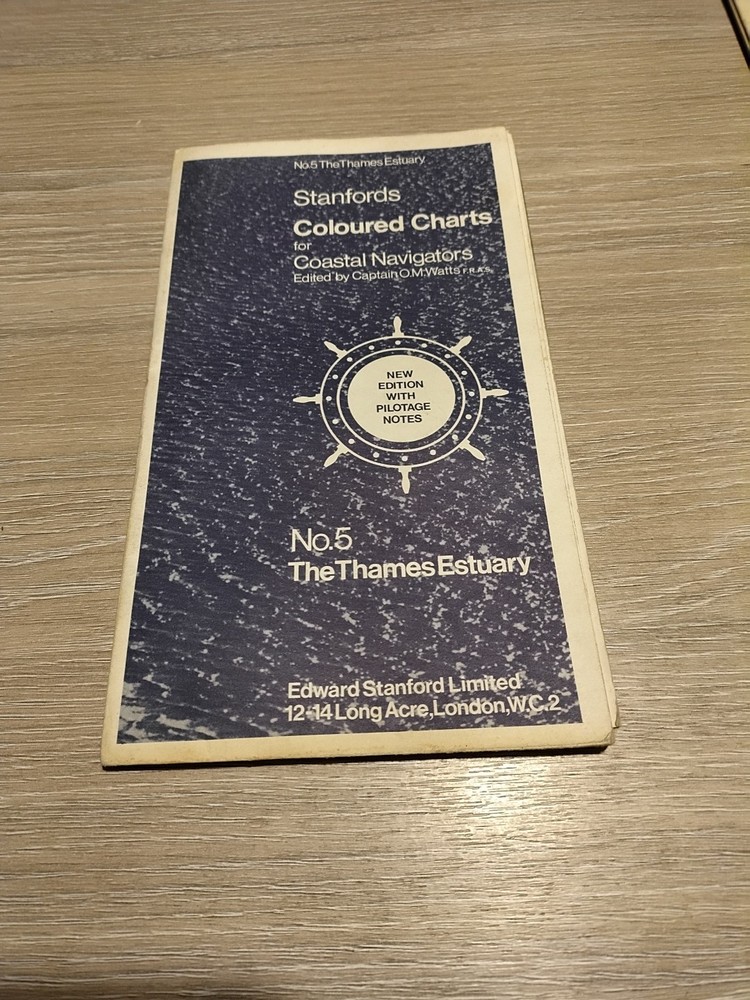

Stanfords Coloured Chart No.5 The Thames Estuary
USD 8.31 USD
Specifications
| Country Of Origin | United Kingdom |
| Type | Coloured Chart |
| Language | English |
| Country | United Kingdom |
| Region | Great Britain |
| Author | Stanford's |
| Features | Folding Map |
| Publisher | Stanfords |
Delve into the intricate detail of the Thames Estuary with Stanfords' Coloured Chart No.5, a must-have for enthusiasts of cartography and history alike. This folding map, produced by the esteemed publisher Stanfords, showcases the vibrant and historical significance of one of Great Britain's most iconic waterways. Crafted with English speakers in mind, this chart is a testament to the region's beauty and the ingenuity of British cartographers. Whether for educational purposes or personal interest, this chart serves as an invaluable resource for understanding the topography and history of the United Kingdom's riverine landscapes.
Related Items
West Cornforth 1915 Durham Sheet 35.06 by Alan Godfrey

Carrick (Map) 1: 50 000 Series Geological Maps (Scotland) (UK IMPORT)

World Atlas, The Signet Hammond: Completely Revised & Updated by B. M. Willett
Greenock, Largs and Millport by Ordnance Survey (Sheet map, folded)

An Atlas of Tolkien (Tolkien Illustrated Guides)

London S.W. Ordnance Survey OS Sheet 170 Quarter-Inch Map 1962 Seventh Series

West Cumbria, Cockermouth, Wast Water – OS map 89 – Ordnance Survey Landranger

Vintage Geological Survey “Ten-Mile” Maps – Sheet One 1948 & Sheet Two 1957