
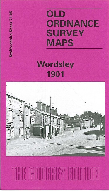
Wordsley 1901 Staffordshire Sheet 71.05 by Stan Hill
USD 5.00 USD
Specifications
| Type | Street Map/Directory |
| Author | Stan Hill |
| Publisher | Alan Godfrey Maps |
| Topic | Local History |
| Subject | History |
| Country Of Origin | United Kingdom |
| ISBN | 9780850549942 |
This detailed map covers much of Wordsley, at the edge of the Black Country. Coverage extends from Holy Trinity church westward to Lawns Wood and the Kidderminster-Wolverhampton road The map is a semi-rural one and the main features are at Wordsley, where they include Holy Trinity church, Wordsley House, Wordsley Flint Glass Works, Woodfield House, disused glass works, rectory, The Green, Bellevue area, Old Tack Farm. A section of the Stourbridge Canal is shown, including The Junction, and disused Dial Iron Works and Audnam Foundry.
Related Items
Muswell Hill 1894 (London Sheet 11.2) – Old OS Maps
Geographia Cloth Road Map Environs of Bournemouth Boscombe Salisbury Southampton
Croydon (NE) 1895 London Sheet 155

Rastrick 1905 Yorkshire sheet 246.03 by Alan Godfrey
Harmondsworth & Longford 1935 Middlesex Sheet 19.03 by Tony Painter

Ordnance Survey (OS) 1:25,000 First Series Map Sheet SN 86 Claerwen
Cowes 1908 Isle of Wight Sheet 90.02 by Tony Painter

Bartholomew’s Map of Historical SCOTLAND Scottish History Clans Coats of Arms