
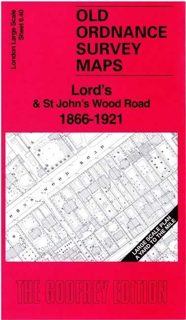
Lord’s & St John’s Wood Road 1866-1921 London Large Scale 6.40 by Alan Godfrey
USD 4.79 USD
Specifications
| Type | Street Map/Directory |
| Author | Alan Godfrey |
| Publisher | Alan Godfrey Maps |
| Topic | Local History |
| Subject | History |
| Country Of Origin | United Kingdom |
| ISBN | 9781787218956 |
This very detailed map covers the area around and to the east of Lord's Cricket Ground, with coverage extending eastward to part of Regent's Park. Features include Lord's, Regent's Park Baptist College, St Dunstans (later replaced by Winfield House, home to the US ambassador), Metropolitan Railway with the first St John's Wood Station, North Villa, Hanover Lodge, Grove Lodge, Regent's Canal, St John's Wood Chapel and Cemetery, Clergy Orphan School, Wellington Nursery etc. The 1921 version of the map is on the reverse, together with a 2,000 word introduction to the history of the area.
Related Items

Corbridge 1921 Northumberland Sheet 92.09 by Alan Godfrey

Nidderdale & Mid Wharfedale 1910 One Inch Sheet 61 by Derrick Pratt

!! Two Maps !! OS Ordnance Survey Landranger Map 103 104 Blackburn Leeds
1987 Ordnance Survey Landranger Second Series Map 176 West London

HARBORNE 1901 ~ Old Ordnance Survey Maps ~ Godfrey Edition
Vintage 1960s Mid Century Bartholomew Half-Inch Contoured Folding Maps Scotland

Chris Makepeace Timperley 1897 (Map) (UK IMPORT)

COVENTRY & RUGBY Ordnance Survey One Inch Sheet 132 1967 Hinckley