
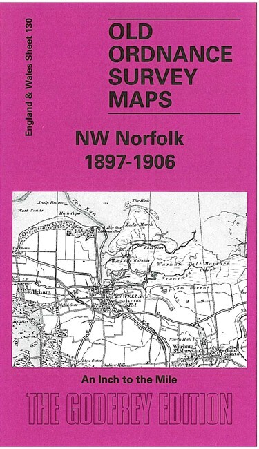
NW Norfolk 1897-1906 One Inch Sheet 130 by Mary Presland
USD 5.05 USD
Specifications
| Publication Year | 2003 |
| Type | One Inch Map |
| Author | Mary Presland |
| Publisher | Alan Godfrey Maps |
| Topic | Local History |
| Subject | History |
| Country Of Origin | United Kingdom |
| ISBN | 9781841515250 |
Coverage stretches from Ringstead eastward to Stiffkey, and from the coast southward to Fring and Great Snoring. Features include an interesting coastal area, with Brancaster Bay, Holkham Bay, and the salt marshes near Wells and Stiffkey; the long closed railways to Wells, the West Norfolk Branch and the Wymondham & Wells Branch; and the large park of Holkham Hall, near the centre of the map.
Related Items

Kettering Corby Northamptonshire & surrounding area OS Landranger GB Map 1:50000
Original Vintage 4th Ed A Description Of The OS Large Scale Maps Book 1930

AA Greater London Street Atlas 1978 Hardback Book

Collection of 13 Ordnance Survey Explorer Maps scale 1:25 000 see details

102 103 104 105 CORNWALL AQUA ACTIVE WATERPROOF EXPLORER ORDNANCE SURVEY MAPS OS
GEOGRAPHERS FAMOUS GUIDE TO LONDON – 1959 – PB

John Griffiths Leeds, Wetherby and District 1910 (Map)
Maryport (East) 1923 Cumberland Sheet 45.05 by Sarah Lee