

Port Glasgow 1896 Renfreshire Sheet 2.11 by Gilbert Bell
USD 5.04 USD
Specifications
| Type | Street Map/Directory |
| Author | Gilbert Bell |
| Publisher | Alan Godfrey Maps |
| Topic | Local History |
| Subject | History |
| Country Of Origin | United Kingdom |
| ISBN | 9781841515526 |
This detailed map covers Port Glasgow, to the SE of Greenock. Coverage runs from Pottery Street and Gibshill eastward to the East Quay, and from the Clyde southward to East Douglehill. Features include CR Greenock Branch with Bogston and Port Glasgow stations, Wemyss Bay Junction, stretch of GSWR Greenock Branch, Ladyburn area, Bogston, Inch Works, Knocknairs Hill, Lily Bank, Birkmyre Park, Chapelton Bridge, Glen Works, shipbuilding yards, Mast Yard, tramway, West and East Harbour, Wet Dock, Gourock Rope Works, dry dock, lighthouses, churches, etc. On the reverse we include extracts from a trade directory.
Related Items

Amble 1896 Northumberland Sheet 46.04 by John Griffiths
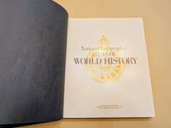
National Geographic Atlas of World History Hardcover Atlas by Noel Grove English

Ordnance Survey Landranger Map Sheet 104 Leeds & Bradford 1984. T3

Cassini Historical Map Set. 3 Maps Matches O.S. Landranger 189. Ashford & Romney

Joblot 13 x 1990s LANDRANGER 1:5000maps (D7) joblot)

Bartholomew’s Revised Half-Inch Contoured Map. – Sheet 15 – Herts & Bucks -Cloth

Melway Greater Melbourne Street Directory 2004 – Edition 31

NORTHAMPTONSHIRE TOWN CENTRE STREET MAPS – Red Book