
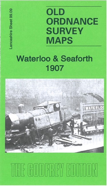
Waterloo & Seaforth 1907 Lancashire Sheet 99.09a by Kay Parrott
USD 5.04 USD
Specifications
| Publication Year | 2023 |
| Type | Street Map/Directory |
| Author | Kay Parrott |
| Publisher | Alan Godfrey Maps |
| Topic | Local History |
| Subject | History |
| Country Of Origin | United Kingdom |
| ISBN | 9781787216181 |
We have published two versions of this detailed map, showing how the area changed across the years. The maps cover Waterloo, a few miles north of Liverpool, plus the northern part of Seaforth and western part of Litherland. Coverage stretches from Milton Road southward to Clarement Road, and from the coast inland to Litherland Park. Features include Waterloo Park, Seaforth Barracks, Lewlithia Park, railway with station, Christ Church, Marine Terrace Green, tramways, Leeds & Liverpool Canal, Litherland Tannery, Sefton Tannery, sugar refinery, Diamond Laundry, etc. On the reverse we include sheet 98.12 which extends coverage eastward to include the Oxford Drive area.
Related Items

Ben Nevis Mamores & Grey Corries by Harvey Map Services Ltd. (Sheet map, folded)
AZ BARNETT’S TOWN Street GUIDES SOUTH EAST ANGLIA LONDON RED BOOK OS MAPS LOT

Childwall & Court Hey 1906: Lancashire Sheet 107.13 by Kay Parrott Folded Book

1982 Ordnance Survey Outdoor Leisure Map The English Lakes North East Sheet

Vintage Ordinance Survey Map Sheet Grantown-on-Spey Archaeology Division Stamp

Canterbury & East Kent England OS Landranger GB Map 1:50000 First Series

Beckenham 1930 Kent Sheet 7.15 by Alan Godfrey

Kensington (Earls Court Road) 1865-94 London Large Scale 6.98 by Alan Godfrey