
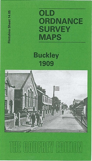
Buckley 1909 Flintshire sheet 14.05 by Derrick Pratt
USD 5.04 USD
Specifications
| Type | Street Map/Directory |
| Author | Derrick Pratt |
| Publisher | Alan Godfrey Maps |
| Topic | Local History |
| Subject | History |
| Country Of Origin | United Kingdom |
| ISBN | 9781841517865 |
This detailed map of Buckley is double-sided for maximum coverage. The main map covers the area from Victoria Terrace and Brunswick Road westward to Bryn-y-bal and part of Mynydd-isa, and northward to Buckley Mountain. Features include South Buckley Brick Works with mineral railway and tramway, High Street area, The Square, Emmanuel church, Pren-Brigog, Wat's Dike, Willow Colliery (disused), Ewloe Pottery, Belmount Brick Works, Ewloe Place, old coal shafts, chapels, etc. On the reverse we include part of adjacent sheet 14.09 extending coverage southward to include Padeswood & Buckley station and short stretch of LNWR Mold Branch, Bistre Farm, Nant-Mawr area, Garreg-lwyd.
Related Items
Halewood 1904 Lancashire Sheet 114.06 by Kay Parrott

LOUGHBOROUGH MELTON MOWBRAY street plan fold out black/white

Osterley Park 1894 or 1935 Middlesex Sheet 20.03

8 x OS MAPS JOB LOT Landranger Ordnance Survey (G8)
1982 ROTHERHAM Ordnance Survey 1:25000 Pathfinder Map SK49/59 Yorkshire
Lot 54 x Vintage Road Maps /Ordnance Survey | Geographia | Bartholomew AA RAC
Gall & Inglis Cycling & Touring Map No 36 Merion, Shrop & Flint Shires c1894

MAP OF Chichester (South) 1933 Sussex Sheet 61.11 by Mike Jee NEW